Chesapeake Community Modeling Program
the new CCMP Newsletter | June 2008
Volume 1, Issue 2
Introduction
With this issue we are introducing a new feature: at the end of some posts you will see a link to our blog, where you are invited to submit your comments, suggestions, and ideas. Hopefully this can make the newsletter more interactive, appealing and useful to the community. If you have something you would like to share, be sure to follow the blog link to leave a comment.

Contents
1. CheMS'08
2. CCMP News in brief
3. News from other communities
4. Open Source on the March
5. Featured Blog Question: How can we improve the CCMP newsletter?
6. CCMP membership
7. Featured Modeler: Doug Wilson
8. Featured Model: ChesROMS
9. Announcement: Job opportunities @ NOAA & USACE
1. CheMS'08
The Chesapeake Modeling Symposium '08 was a success. We had over 110 registered participants, 9 workshops, and 7 plenary talks. It appears that most of the attendees appreciated the format of the Symposium and the fact that we focused on discussions and interactions, promoting lively participation and exchange of ideas.
The CheMS'08 website has been updated to include a list of participants (with contact information) as well as most of the presentations that were delivered during the meeting. If you find your presentation missing and do not mind sharing it, please let us know and we will be glad to post it. Please stay in touch and help develop our community efforts.
As a result of our discussions during the Symposium we are now expecting three more models to be served from the CCMP umbrella. Please consider sharing your models, documentation and data with the community. It will eventually help you find partners, collaborators, users, and clients: all of which will make your product better. The CCMP will be happy to assist you with the SourceForge setup, as well as with further dissemination of your results.
Perhaps even more important than collecting individual models, we seem to be building a community that can, hopefully, lift our research to a new level of understanding and more efficient decision support. Networks and collaboration are essential for such community efforts. Please share your ideas on how to move CCMP forward and how we can best serve your needs. In particular, please let us know what you liked and did not like during the Symposium. Our plan is to make it a regular bi-annual event: if we hear your feedback, we can make it better in the future.
2. CCMP News in brief
PIHM Model Available via CCMP, SourceForge
As promised last time, the Penn State Integrated Hydrologic Model PIHM is now available from SourceForge. Our praise and thanks go to Chris Duffy, Mukesh Kumar, and Gopal Bhatt. Check out this great new addition to the Open Modeling community efforts. More links are also available from the CCMP modeling web page. PIHM is distributed under the GNU General Public License.
USGS developing COAST
USGS partners at CBP are developing the Chesapeake Online Assessment Support Tool (COAST). It is a series of web-enabled tools with links to databases and model output that should allow managers to make the right decisions. Leaders are Scott Phillips (USGS) and Olivia Devereux (UMD). The first release is due September 2008.
COAST should help to:
- Map the range of nutrient yields
- Test alternative scenarios
- Assess water-quality change and progress in meeting goals
- Understand the factors affecting water quality
Another component of COAST is the scenario builder. It will allow the user to test alternative management scenarios based on the CBP Phase V watershed model and the new user interface known as “Vortex”. The “Vortex” allows users to request creation of model input data, explore alternative management scenarios, and visualize and analyze model inputs and outputs. In the future, links to other models (such as state and local government efforts) will be part of this component.
For more information contact Cassandra Ladino, Scott Phillips or Kelly Shenk.
For more information on the USGS decision support efforts click here.
3. News from other communities
In April, Alexey Voinov had a chance to visit several European groups that are developing tools to link models and modules together.
OpenMI
OpenMI stands for Open Model Interface. It's an outgrowth of a large water-related European project called HarmonIT. It was developed to help make models work together and talk to each other. To be OMI compliant the model does not need to be open source. This makes the approach especially lucrative for private consultants and proprietary software developers. OpenMI itself is open source and it is supported by some very major European players, including DHI Water Environment and Health (DK), Wallingford Software Ltd. (UK) and WL Delft Hydraulics (Netherlands). The latter has recently merged with several other hydrology related institutes and became Deltares.
Currently the collection of OMI-compliant models contains some 30+ models from 14 organizations. In USA the OpenMI has been embraced by CUAHSI, and there is a version of a well known HEC-RAS model from the Army Corps of Engineers Hydrologic Engineering Center that is OpenMI compliant. Other important models in the collection are MODFLOW, Delft3D, MIKE SHE and others. Just recently in May there was a joint video conference with US EPA to discuss future collaboration opportunities between the US EPA and the OpenMI team.
Technically speaking, OpenMI standard is a software component interface definition for the computational core (the engine) of the computational models in the water domain. Model components that comply with this standard can, without any programming, be configured to exchange data during computation (at run-time). This means that combined systems can be created, based on OpenMI-compliant models from different providers, thus enabling the modeler to use those models that are best suited to a particular project. The standard supports two-way links where the involved models mutually depend on calculation results from each other. Linked models may run asynchronously with respect to timesteps, and data represented on different geometries (grids) can be exchanged. The OpenMI standard is defined by a set of software interfaces that a compliant model or component must implement. These interfaces are available both in C# and Java.
It makes perfect sense to consider OpenMI as a means for integrating some of the Chesapeake models. Some limitations to keep in mind: so far OpenMI supports only structured grids and does not support parallel computing. However there are plans to expand in both of these directions. The approach they take is that "if OpenMI is not fit for your purpose, let's figure out why and make it fit". This is promising and it may make sense to become an associate member of the OpenMI Association, which strives to become a standards organization similar to OGC (Open Geospatial Consortium).
SEAMLESS
This stands for "System for Environmental and Agricultural Modeling: Linking European Science and Society". SEAMLESS involves 29 research institutions from thirteen European countries, Mali and the USA. The project uses some of the OpenMI formalism, however it is more about decision making and getting the agricultural models operational for decision support.
Currently Phase I of the project is about linking the following models and respective databases: APES - Agricultural Production and Externalities Simulator (a suit of agricultural components that includes several models to simulate weather; a model for Crop growth (3-5 crops); a SoilWaterErosion model; a SoilCarbonNitrogen model; a Pesticides model; AgroManagement model to simulate planting, fertilization (N), irrigation, tillage, harvest); FSSIM-AM (management tools for current and alternative activities (Flevoland)); FSSIM-MP (models for selected farm types (Flevoland)); EXPAMOD (Extrapolation tool from one sample region to another); CAPRI (a partially integrated Scenario Editor); and an Indicator calculator.
Since agricultural loadings are of prime importance for the Chesapeake watershed, it might be a good idea to explore how some of these models and tools can be made applicable to our system. There are similar efforts now underway in USDA at Fort Collins lab, which also need to be explored. We will report about that in our next issue.
GEONAMICA
GEONAMICA is an object-oriented application framework developed and supported by Research Institute for Knowledge Systems (RIKS since 1990. It is specially tailored for developing Spatial Decision Support Systems featuring integrated dynamic models as their core element. It is an extendible toolbox for the DSS developer containing ready to use software building blocks required for the development of models, analysis tools and user interfaces.
In this case we are talking about a proprietary software package, essentially a library that is used by the Institute to develop their applications tailored for various geographical locations. The system is based on the DEVS formalism, which stands for Discrete Event System Specification, a modular and hierarchical formalism for modeling and analyzing general systems. These can be discrete event systems which might be described by state transition tables, and continuous state systems which might be described by differential equations (or continuous systems), and hybrid continuous state and discrete event systems. DEVS dates back to 1976, but it is certainly worth exploring if we are to build components suitable for future integration and coupling. DEVS spells out very specific rules for software development that make components readily available for further integration.
Chances are that GEONAMICA may go the open source route, in which case it may become a useful tool for our model integration efforts.
4. Open Source on the March
MIT cell phone project highlights possible applications of open-source systems.
The AP (5/13) reports that Massachusetts Institute of Technology (MIT) professor Hal Abelson assigned "20 computer science students this semester" to "[d]esign a software program for cell phones that use Google's upcoming Android mobile operating system." According to the AP, the results "revealed the power of an open system like Android to shake up the mobile phone industry, where wireless companies are being pressured to loosen the control they have maintained over what devices do." Many of the MIT projects emphasized location tracking. For example, "[o]ne project named GeoLife gives users a way to set to-do lists and get reminders on their phones" when they are near a specific location. "Another effort, named Flare, was designed to help small businesses like pizza shops cheaply track their drivers." And the Locale program "lets users configure their phones to automatically adjust their settings when the devices detect themselves in certain zones." The AP notes that the Locale "group won $25,000 and advanced to the finals of a $10 million Android developers challenge Google is running."
With models in Open Source perhaps a day may come when professors will give ecology and hydrology students assignments to develop new components within our already shared models to advance their functionality.
5. Featured Blog Question: How can we improve the CCMP newsletter?
We would love to hear some community feedback to help us improve this newsletter and make it more useful. What other content would you like to see? How can we improve the format? What you like and what you don't like? Should we send this out at all?
Your thoughts? Please share them with the community by leaving a comment on our blog.
- Click here to share your newsletter ideas on the CCMP blog
The question we asked last time was: "Do we need by-laws?"
Perhaps the strongest opinion came from Tom Gross, the former CCMP manager: "Perhaps I have been within the Byzantine world of the UN too long, but I now believe there is a role for some sort of Terms of Reference. It helps to be able to refer to a basic set of guidelines now and again. It should have a three sentence purpose statement. Perhaps several main goals. A statement of structure, so that people outside of the inner circle can trust and understand it."
Makes sense. Perhaps we do need to work on some terms of reference or by-laws in the future.
6. CCMP membership
As another step toward better community integration and botton-up feed-in, we would like to establish CCMP membership. Anybody who has an interest in Chesapeake related modeling or data efforts is welcome to become a member of the CCMP.
To become a member we ask that you register on the CCMP website... it takes only a few seconds!
We would like to use this membership list also to send out our future mailings, so that we can make sure that these mailings are not treated as SPAM. Future CCMP Newsletters and announcements will go only to our members. Certainly we will never share your address and other information with anybody outside the community.
- Click here to register yourself with CCMP.
7. Featured Modeler: Doug Wilson
Doug Wilson, NOAA [homepage]
After spending 20 years at the NOAA Atlantic Oceanographic and Meteorological Laboratory in Miami, specializing in ocean climate studies, low-latitude circulation dynamics, and observing system development in the Caribbean and South Florida, Doug moved to the NOAA Chesapeake Bay Office, and in 2002 he initiated the Integrated Coastal Observations Program there. His research interests cover a wide range of issues including ocean circulation and heat transport; oceanography of the Caribbean Sea, western tropical Atlantic, and Gulf of Mexico; integrated ocean observing systems; current measurement and instrument development; western boundary currents; equatorial ocean dynamics.
 Doug is a major player on the CBOS - Chesapeake Bay Observing System project. He is coordinating the NOAA Chesapeake Bay Interpretive Buoy System (CBIBS).
Buoys in the Chesapeake are distributed around the bay collecting and making available many real-time measurements including meteorological, physical, water quality, water level, chemical, and biological observations. Data from the buoys, including other environmental, geographic, and historical information, is delivered to users via the internet. In addition to providing real-time observations, NOAA's Chesapeake Bay Office uses the buoys to support community education and classroom activities.
Doug sits on many important committees, including IOC IOCARIBE-GOOS Steering Committee where he is Co-Chair and Regional Project Coordinator, US White Water to Blue Water Initiative Steering Committee, Intra-Americas Sea Initiative Executive Committee. He is also NOS-COOP OSTEP Advisory Board Member and WOCE Data Products Committee (ADCP). He is currently on detail at NOAA/NOS and will hopefully foster greater awareness of CB and CBOS activities with the NOAA IOOS program. Thank you Doug for also finding time to help the CCMP Steering Committee make the right decisions and guide our program.
8. Featured Model: ChesROMS
Our featured model in this issue of the newsletter is:
ChesROMS
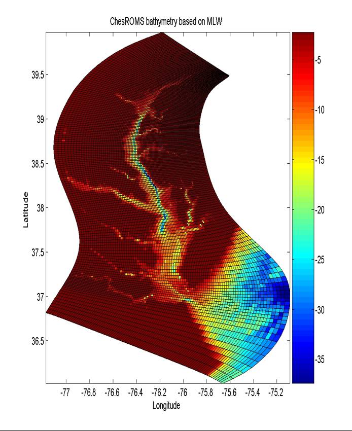 ChesROMS is a a community ocean modeling system for the Chesapeake Bay region being developed by scientists in NOAA, University of Maryland, CRC (Chesapeake Research Consortium) and MD DNR (Maryland Department of Natural Resources) supported by the NOAA MERHAB program. The model is built based on the Rutgers Regional Ocean Modeling System (ROMS) with significant adaptations for the Chesapeake Bay. It runs under Linux and is open source.
The model has been developed by a joint effort team of investigators, including: Chris Brown (NOAA/NESDIS), Tom Gross (formerly CRC - now UNESCO), Raleigh Hood (UMCES-HPL), L. Lanerolle (NOAA/NOS/OCS), Wen Long (UMCES-HPL), Raghu Murtugudde (ESSIC-UMD), J. Wiggert (CCPO-ODU), J. Xu (UMCES-HPL).
The model was one of the first in CCMP to make full use of SourceForge. The project uses SourceForge to serve latest model releases, support public forums and for bug tracking. It is one of the exemplar efforts in CCMP, and has been led by Raleigh Hood.
9. Announcement: Job opportunities @ NOAA & USACE
Open Coastal Modeler @ NOAA's National Ocean Service
NOAA's National Ocean Service (NOS) has an announcement for a federal position for an operational coastal modeler. This position is located in Silver Spring, MD, USA, and has a salary range of 39,330.00 - 90,698.00 USD per year. The application deadline is June 5th. Please forward this information to potentially interested friends and colleagues.
Desired skills and abilities include: an interest in operational coastal modeling, knowledge in physical oceanography, hydrodynamic coastal models including ROMS, and computer programming (fortran, unix, netcdf).
This position will be focused on assisting with the transition of the hydrodynamic forecast models from development to operations and to assist in the operational oversight of the model systems.
This position can be applied for here (Job Announcement Numbers: NOS-COOPS-2008-0005 and NOS-COOPS-2008-0006).
The DE (non status) vacancy announcement for the subject position is now posted and can be viewed here.
The MAP (status) vacancy announcement for the subject position is now posted and can be viewed here.
US Army Engineer Research and Development Center
The Environmental Laboratory of the U.S. Army Engineer Research and Development Center, Vicksburg, MS, is seeking an individual with expertise in modeling aquatic and marine environmental systems. Candidates should have a PhD in environmental science, engineering, or related field and should be capable of applying multi-dimensional, mass-conservation based models that incorporate aspects of aquatic physics, chemistry, and biology. This position provides opportunity to work with established experts in the field and to collaborate with specialists in other fields to develop solutions to complex environmental issues of national and international importance. US citizenship is required. This is a full time, permanent DB04 position (GS12-GS14), and starting salary will depend on qualifications and experience. The US Army Engineer Research and Development Center is an Equal Opportunity Employer.
Candidates can send resume to Pamala.K.Corulla@erdc.usace.army.mil or contact Ms. Corulla by phone at 601-634-3861.
Chesapeake Community Model Program
http://ches.communitymodeling.org/
Chesapeake Research Consortium
Edgewater, MD
410-798-1283